| Ā |
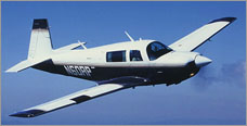
 What follows is the complete, final itinerary actually flown, as a result of consideration of all the following factors:
- availability of avgas fuel at each destination,
- the effects of updated winds aloft forecasts on potential safe ranges for the fully fueled airplane,
- the ability to obtain formal approvals for overflights and landings from local governments (e.g., these became unavailable for American registered aircraft to cross the Middle East following cruise missile attacks by the US on Afghanistan and Sudan),
- consideration of US State Department military security briefings regarding relative risks of flying to certain destinations and via certain routes (e.g., Sri Lanka was not overflown or used as a destination due to threats of ground-to-air Stinger missile attacks by insurgents in that country, which in fact led to the downing of a civilian aircraft by the rebels soon afterward), and, of course,
- since this was a vacation trip, the attractiveness of any potential destination as a pleasure stop was a paramount consideration!
Dates shown below are in local times for the departures from each airport. Many flights were long enough to involve a takeoff on one day and a landing on the next.
Flight times shown were as indicated on the airplane's Hobbs meter, which displays the total clock time between engine start and engine shutdown. These times thus include engine warm-up, taxi, engine and instrument testing runs, and post landing taxiing times, in addition to actual time in the air. To convert these times for an estimation of actual time in the air, approximately 15 - 20 minutes should be subtracted per leg flown.
Distances are given in great circle, point to point calculations from each departure airport to each destination airport. Actual flights were typically made along longer, doglegged routes, so the distances shown below are thus conservative estimates. All distances are shown in statute miles.
To access reports on these legs, most of which include photographs as well, just click on any selected leg title below:
| Frederick, MD - Memphis, TN |
| 30 August 98 |
764 miles |
5.1 hours |
| Memphis, TN - Amarillo, TX |
| 31 August 98 |
666 miles |
4.4 hours |
| Amarillo, TX - Las Vegas, NV |
| 31 August 98 |
770 miles |
6.0 hours |
| Las Vegas, NV - Hayward, CA |
| 1 September 98 |
405 miles |
3.7 hours |
| Hayward, CA - Oakland, CA |
| 4 September 98 |
7 miles |
0.8 hours |
| Oakland, CA - Hilo, HI |
| 5 September 98 |
2,355 miles |
14.7 hours |
| Hilo, HI - Kona, HI |
| 9 September 98 |
67 miles |
1.1 hours |
| Kona, HI - Apia, Western Samoa (the longest single leg of the trip) |
| 10 September 98 |
2,590 miles |
15.9 hours |
| Apia, Western Samoa - Pago Pago, American Samoa |
| 14 September 98 |
95 miles |
1.4 hours |
| Pago Pago, American Samoa - Nadi, Fiji Islands |
| 14 September 98 |
832 miles |
6.2 hours |
| Nadi, Fiji Islands - Brisbane, Australia (Brisbane International Airport) |
| 17 September 98 |
1,707 miles |
10.8 hours |
| Brisbane, Australia (Intn'l Arpt) - Brisbane Australia (Archerfield Airport) |
| 18 September 98 |
15 miles |
0.7 hours |
| Brisbane, Australia (Archerfield Arpt) - Mt. Isa, Australia |
| 21 September 98 |
988 miles |
6.7 hours |
| Mt. Isa, Australia - Darwin, Australia |
| 21 September 98 |
817 miles |
5.4 hours |
| Darwin, Australia - Singapore |
| 25 September 98 |
2,102 miles |
13.1 hours |
| Singapore - Johor Bahru, Malaysia |
| 30 September 98 |
21 miles |
0.7 hours |
| Johor Bahru, Malaysia - Chennai (Madras), India |
| 1 October 98 |
1,812 miles |
13.3 hours |
| Chennai (Madras), India - Trivandrum, India |
| 3 October 98 |
387 miles |
3.1 hours |
| Trivandrum, India - Seychelles, Seychelles Islands |
| 3 October 98 |
1,755 miles |
12.4 hours |
| Seychelles, Seychelles Islands - Harare, Zimbabwe |
| 7 October 98 |
1,912 miles |
11.9 hours |
| Harare, Zimbabwe - Hwange National Park, Zimbabwe |
| 10 October 98 |
277 miles |
2.3 hours |
| Hwange National Park, Zimbabwe - Victoria Falls, Zimbabwe |
| 12 October 98 |
86 miles |
0.9 hours |
| Victoria Falls, Zimbabwe - Windhoek, Namibia (Windhoek International Airport) |
| 13 October 98 |
630 miles |
4.2 hours |
| Windhoek, Namibia (Intn'l Arpt) - Windhoek, Namibia (Eros Airport) |
| 14 October 98 |
29 miles |
0.8 hours |
| Windhoek, Namibia (Eros Arpt) - Walvis Bay, Namibia |
| 15 October 98 |
162 miles |
1.5 hours |
| Walvis Bay, Namibia - Libreville, Gabon |
| 16 October 98 |
1,679 miles |
10.8 hours |
| Libreville, Gabon - Sao Tome |
| 17 October 98 |
189 miles |
1.6 hours |
| Sao Tome - Abidjan, Ivory Coast |
| 18 October 98 |
818 miles |
5.1 hours |
| Abidjan, Ivory Coast - Sal, Cape Verde Islands |
| 20 October 98 |
1,533 miles |
10.2 hours |
| Sal, Cape Verde Islands - Bridgetown, Barbados |
| 22 October 98 |
2,482 miles |
14.4 hours |
| Bridgetown, Barbados - San Juan, Puerto Rico |
| 25 October 98 |
578 miles |
4.1 hours |
| San Juan, Puerto Rico - Frederick, MD |
| 26 October 98 |
1,622 miles |
11.2 hours |
Trip grand totals:
30,152 statute miles
204.5 Hobbs hours
Home | Itinerary | Notes to Pilots | Ham Radio | Thank You


Designed by MindSpring
Ā
|
Ā |
![[image map, use itinerary]](/grphx/n_globe.gif)